Maps, Charts, Lake Photos
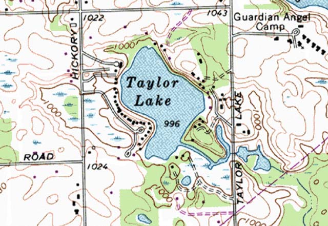
This image is from a 1969 United States Geological Survey topographic map. The revisions performed in 1983 are shown in purple. It shows the lake level at 996 feet above sea level. The 1000-foot contour interval is a significant one for the lake. Areas near the lake within the 1000-foot contour are likely to be wet or marginal lands. This contour does a good job of delineating the Hickory Ridge-Pellet wetland to the west of the lake, and the contiguous wetlands to the southeast of the lake.